
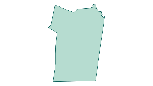
County outline
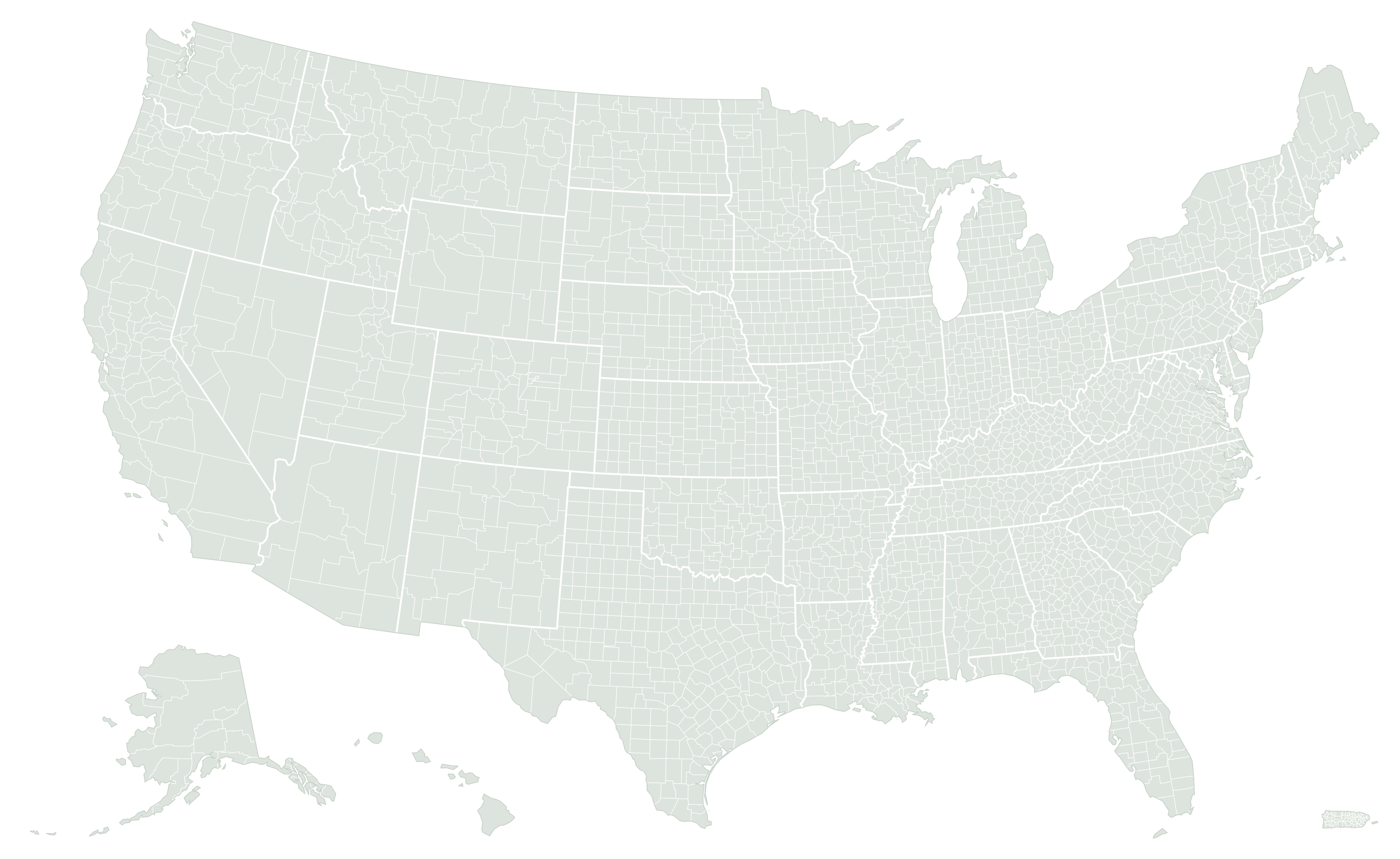
Where Christian County is located
Area breakdown
Land accounts for 99.1% of Christian County’s measured area and water for 0.9%. Its combined area converts to 1,875.3 square kilometers or approximately 463,388 acres.
Green: land · blue: water
| Measurement | Square miles | Square kilometers | Acres |
|---|---|---|---|
| Land | 717.794 | 1,859.078 | 459,388.2 |
| Water | 6.249 | 16.185 | 3,999.4 |
| Total | 724.043 | 1,875.263 | 463,387.5 |
How Christian County compares
By original Census land area, Christian County ranks #2 of 120 in Kentucky and #1253 of 3,222 nationally. National rankings include the 50 states, District of Columbia, and Puerto Rico.
Its land area is 2.346 times the Kentucky county-equivalent median of 306 square miles. It accounts for 1.8% of the combined county land area in the state.
See the complete Kentucky ranking · What counts as a county equivalent?
Population and density of Christian County
The Census Bureau estimates that 70,115 people lived in Christian County on July 1, 2025. That ranks #803 of 3,222 county equivalents nationally and #12 of 120 in Kentucky. Since the April 1, 2020 estimates base of 72,799, the population has declined by 2,684 (−3.7%), compared with +2.2% for Kentucky as a whole.
With 717.8 square miles of land, that is 98 people per square mile (38 per km²), placing Christian County #1,010 nationally for density and #34 in Kentucky. The median county equivalent has 47 people per square mile; the Kentucky median is 59. Put another way, there are about 6.6 acres of land per resident.
| July 1 | 2020 | 2021 | 2022 | 2023 | 2024 | 2025 |
|---|---|---|---|---|---|---|
| Estimate | 72,752 | 73,172 | 72,242 | 71,269 | 71,436 | 70,115 |
| Change | — | +420 | −930 | −973 | +167 | −1,321 |
U.S. Census Bureau, Vintage 2025 population estimates. Estimates are revised each year and are not decennial census counts. Density divides the whole population by the whole county’s land area, so it describes an average, not how settlement is distributed within the county. Population sources and methods.
Cities and towns in Christian County
5 incorporated places lie at least partly in Christian County. Together they are home to 39,910 people (56.9%); the other 30,205 (43.1%) live outside any incorporated place, in unincorporated communities and rural areas.
The largest is Hopkinsville city, with 30,411 residents in the county.
| Incorporated place | Population 2025 | Since 2020 | Land mi² |
|---|---|---|---|
| Hopkinsville cityCounty seat | 30,411 | −2.4% | 32.9 |
| Oak Grove city | 7,830 | −1.3% | 10.7 |
| Pembroke city | 869 | +1% | 1.111 |
| Crofton city | 628 | −4.7% | 0.635 |
| LaFayette city | 172 | −3.4% | 0.258 |
Population: U.S. Census Bureau Vintage 2025 subcounty estimates, counting only the part of each place inside Christian County. Land: 2026 Census Gazetteer, for the whole place even where it extends into other counties. How communities are listed.
Metropolitan area
Christian County is an outlying county of the Clarksville, TN-KY Metropolitan Statistical Area. Its 4 county equivalents have 349,001 residents on 2,158.2 square miles of land; Christian County accounts for 33.3% of the land and 20.1% of the residents. By combined land it ranks #146 of 393 metropolitan areas, and #160 by population.
| County equivalent | Population 2025 | Land mi² |
|---|---|---|
| Montgomery CountyTennessee | 249,935 | 539.2 |
| Christian County | 70,115 | 717.8 |
| Trigg County | 14,512 | 441.4 |
| Stewart CountyTennessee | 14,439 | 459.8 |
ZIP codes
15 ZIP Code Tabulation Areas have land in Christian County; 8 of them have most of their land inside the county, and the others mainly cover neighboring areas.
422154221742220422234223242236422404225442262422664228642408424424245342464
ZIP Code Tabulation Areas are the Census Bureau’s approximations of USPS ZIP Code service areas, from the 2020 Census relationship files. Lighter codes have less than half of their land in this county. Post-office-box and single-address ZIP Codes have no tabulation area.
Counties bordering Christian County
Christian County shares a land border with 7 county equivalents, including 2 in Tennessee. It has more land than every one of them. The largest neighbor is Hopkins County (542.3 mi²) and the smallest is Caldwell County (344.8 mi²). Together with its neighbors, Christian County forms a block of 3,887.1 mi² of land, of which it holds 18.5%.
| Bordering county equivalent | Land mi² | Size vs. Christian | Compare |
|---|---|---|---|
| Hopkins County | 542.3 | 1.3× smaller | Compare |
| Montgomery CountyTennessee | 539.2 | 1.3× smaller | Compare |
| Muhlenberg County | 467.3 | 1.5× smaller | Compare |
| Stewart CountyTennessee | 459.8 | 1.6× smaller | Compare |
| Trigg County | 441.4 | 1.6× smaller | Compare |
| Todd County | 374.5 | 1.9× smaller | Compare |
| Caldwell County | 344.8 | 2.1× smaller | Compare |
How big is Christian County compared with U.S. states?
Christian County has less land than any of the 50 states. Rhode Island, the smallest state by land area, has 1,033.9 mi², about 1.4 times as much. Kentucky’s county land could hold about 55 areas the size of Christian County.
Another way to picture it: the same land area would fill a square about 26.8 miles (43.1 km) on each side. Real county shapes are rarely square, so this is a scale reference rather than a width or driving distance.
State figures are the sums of each state’s county-equivalent land measurements in the same Census release, so states and counties are compared on the same basis. Published state totals can differ slightly because of rounding. Compare all states · Counties bigger than entire states.
What stands out about Christian County?
Christian County has more land than 1,969 of the other 3,221 county equivalents in the dataset.
A median is the middle county-equivalent measurement, not the average of the largest and smallest. All three bars use the same linear scale. Very small areas may appear as a thin sliver; the labels retain their values.
Does including water change its rank?
Using land plus water places Christian County at #1,341 nationally by total area, 88 places farther from the top than its land rank. Other county equivalents gain more area when their water measurements are included.
Its water share is 0.9%, compared with a national county-equivalent median of 1.2% — 0.3 percentage points lower. This describes the statistical geography’s land/water mix, not flood exposure or developable land.
Closest positions in the national land ranking
These entries sit immediately beside Christian County in the national ranking. They can be in different states and are not necessarily geographic neighbors.
| Land rank | County equivalent | Land mi² | Comparison |
|---|---|---|---|
| #1252 | Silver Bow County, Montana | 718 | Compare |
| #1253 | Christian County, Kentucky | 717.8 | This county |
| #1254 | Rush County, Kansas | 717.8 | Compare |
Calculated from the same Census release as the area table. Total-area order uses original ALAND + AWATER; water shares and chart labels use published square miles. Calculation details.
Representative coordinates
The Census internal point is 36.892059, -87.492986. It represents a location inside the geography; it is not necessarily the centroid or the address of a courthouse.
Source and precision
U.S. Census Bureau, 2026 Gazetteer Files, Counties. Original ALAND: 1,859,076,774 m²; AWATER: 16,184,733 m². Rankings use ALAND; exact ties use ascending GEOID. Tables preserve Census-published square miles to three decimals, with conversions based on those values.
Common questions
How big is Christian County?
Christian County, Kentucky has 717.8 square miles (1,859.1 km²) of land and 6.249 square miles of water, for a total area of 724 square miles. It ranks #1253 of 3,222 U.S. county equivalents by land area.
Is Christian County the largest county in Kentucky?
No. Christian County ranks #2 of 120 in Kentucky by land area. The largest is Pike County, with 786.2 square miles of land.
What counties border Christian County?
Christian County shares a land border with Todd County, Trigg County, Hopkins County, Montgomery County, Tennessee, Caldwell County, Muhlenberg County, and Stewart County, Tennessee.
What is the population of Christian County?
The Census Bureau estimates Christian County had 70,115 residents on July 1, 2025, ranking #803 of 3,222 county equivalents. That is 98 people per square mile of land.
What is the county seat of Christian County?
The county seat of Christian County is Hopkinsville.
What cities and towns are in Christian County?
Christian County has 5 incorporated places. The most populous are Hopkinsville city, Oak Grove city, Pembroke city, Crofton city, and LaFayette city; 30,205 residents live outside any incorporated place.
Is Christian County part of a metropolitan area?
Yes. It is an outlying county of the Clarksville, TN-KY Metropolitan Statistical Area, which has 4 county equivalents and 349,001 residents.
How many ZIP codes are in Christian County?
15 ZIP Code Tabulation Areas have land in Christian County, and 8 of them have most of their land inside the county. Census ZIP Code Tabulation Areas approximate USPS ZIP Code areas.
How does Christian County compare with U.S. states?
It has less land than every state. Rhode Island, the smallest, has 1.4 times as much land.
How many acres of land are in Christian County?
The land measurement converts to approximately 459,388 acres. Including water, total area is approximately 463,388 acres. One square mile equals 640 acres.
Why might another source show a different area?
Check whether it reports land or total area, its Census vintage, and its rounding. Our guide explains how to reconcile county area figures.
Can this establish a property boundary?
No. Statistical measurements and generalized maps do not establish property lines. Consult the relevant local surveying or land-records authority.